

| ERUV STATUS: | GOOD FOR USE |
The Dix Hills Eruv is up and running. Below are the boundaries of the Dix Hills Eruv.
Please let us know if you wish to be notified of the Eruv Status by email every week.
CLICK HERE FOR GOOGLE MAP OF THE DIX HILLS ERUV
CLICK HERE FOR DIX HILLS ERUV IN THE NEWS
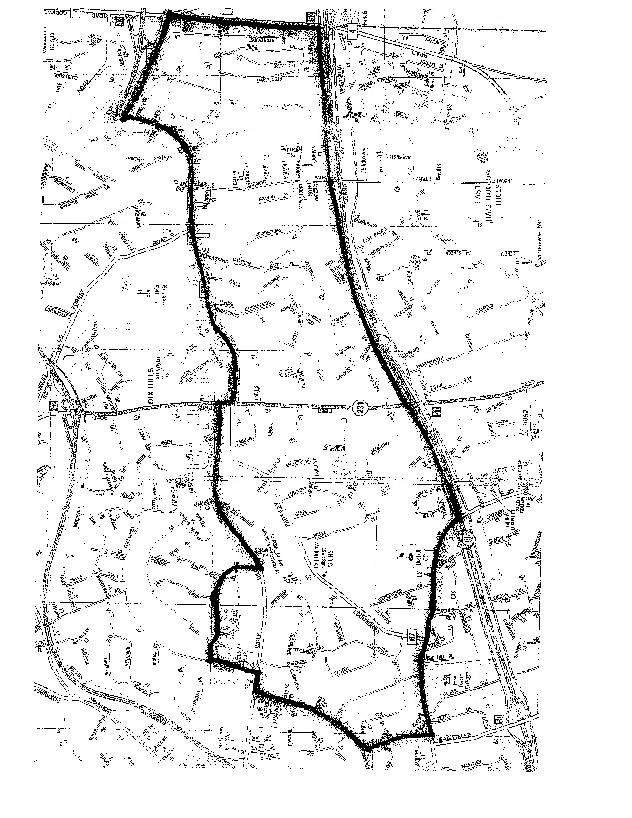 Beginning at the intersection of Deer Park Road (NY 231) and the North Service Road to the Long Island Expressway (I-495), due West along the North Service Road to Half Hollow Road, then North-West along Half Hollow Road to Westcliff Drive, then
North along Westcliff Drive to Melrose Road, then
North-East along Melrose Road to Wolf Hill Road, then
East along Wolf Hill Road to Caledonia Road, then
North along Caledonia Road to Arbor Lane, then
East along Arbor Lane to Lisa Drive, then
East and South along Lisa Drive to Wolf Hill Road, then
East along Wolf Hill Road to Deer Park Road, then
South along Deer Park Road to Vanderbilt Parkway, then
East along Vanderbilt Parkway to Commack Road, then
South along Commack Road to the North Service Road to the LIE, then West along the North Service Road to the point of beginning.